


Tahoe Rim Trail Desolation Wilderness to Tahoe City
- Randy Berton
- Jun 26, 2025
- 2 min read

The resting place:
June 21st 2025.
Saturday night Spoon and I drove around dirt and wind in Jawbone recreational area along Antelope valley found a place behind some wind break and settled in under starry skies.
The Wind calmed down with the beauty of a desert sunrise.
I could not hold back the onset of peace
The Beginning:
Arriving in South Lake Tahoe on Sunday
John and long time childhood friend of spoon drove us up to the I-50 shared Pacific Crest Trail and Tahoe Rim Trail head.
Hiking in a 100 yards we dialed in a perfect tent site.
The Rush:
Spoon and I agreed on a navigational way point at a tent site provided through Farout Map Application.
This makes good company and sense for hikers who might start off the trail with bang as opposed to other hikers who might not start off with a bang..
It allows HYOH the opportunity of ones personal experience of the trail.
Spoon gathered footage as rebo also gathered footage.
We meet at the end of the day sharing about our experiences.
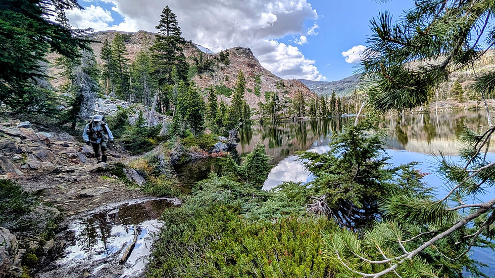
Our first night was at Gilmore Lake TCT Mile Marker on Farout 139.5 (Clockwise)
Setting the Pace:
Getting through Desolation Wilderness and Dick's Pass is where my camera decides to go at a different pace..
My pace is not my own.
The next stop for June 24th 2025 is Richardson Lake TCT Mile 151.1
Ward Creek to Tahoe City:
Arriving to Ward Creek the terrain begins to change ascending towards Granite Chief Wilderness I found fields of small manzanita.
The switch backs going up to where the Tahoe Rim Trail and Pacific Crest Trail separate their way is about 600 '
The descent down from the Granite Chief Wilderness boundary to Ward Creek goes from 8400' to 6700' .


Comments